E-boo
Visualize decision-making support data for civil security helicopters, SMURs and the gendarmerie
- Project name
- E-boo
- Customer
- RP2I & HIS France
- Offer
- Tailor-made web development
Display an interface allowing the organization of helicopter rescue services in France.
The idea
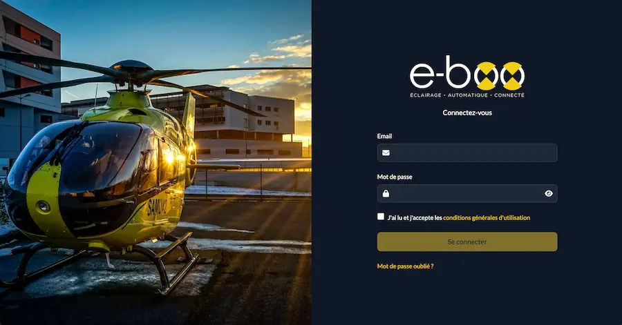
In January 2024, the RP2I teams asked us to redesign an existing platform. The objective was to create a new version that was efficient, ergonomic and with more features than the online version.
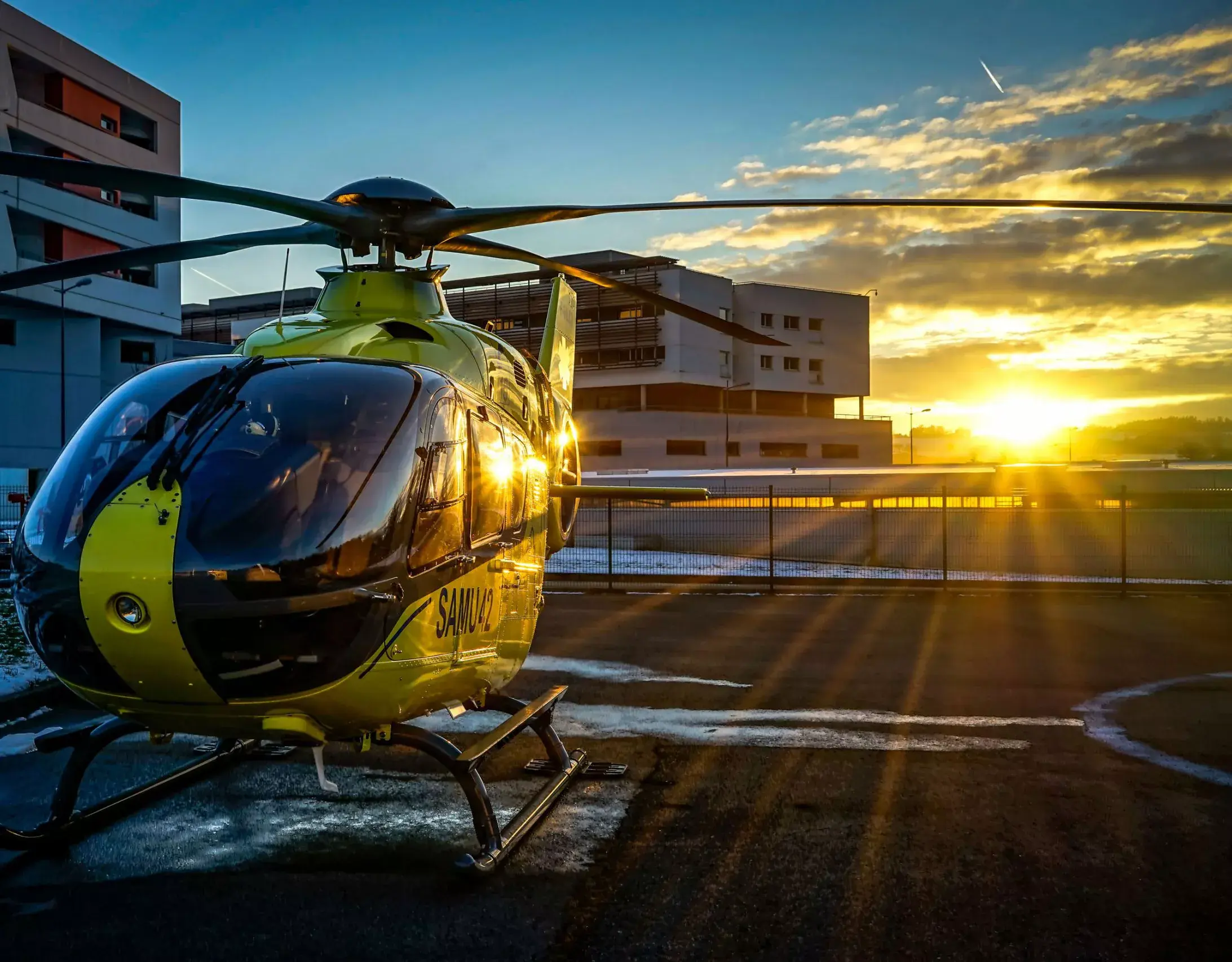
The concept of the product was ambitious: to allow users to have real-time information on helicopter landing zones and to be able to control the lighting of these zones in the event of emergency intervention. A major challenge!
The concept of the product was ambitious: to allow users to have real-time information on helicopter landing zones and to be able to control the lighting of these zones in the event of emergency intervention. A major challenge!
The execution
To be able to create such a product, we started with a blank sheet of paper and divided it into 3 main phases:
1/3 Functional and graphical scoping
Writing functional and technical specifications: we then wrote and specified a Trello board with a precise and methodical breakdown of each functionality of the platform. It is this division into tickets (called “user-stories”) that allows the development teams to create the platform.
Research for technical solutions: once the functional specifications were drawn up, we carried out a phase of research for technical solutions to create the platform. The technical complexity here lay in the multitude of possible emergency response scenarios and lighting of the landing areas.
Graphic models: the first models having already been produced by the client, we were able to base ourselves on this work to produce the specifications and make the necessary graphic adaptations with the help of our client.
2/3 Web development and server implementation
Once the foundations of the house were laid, we were able to begin creating the platform. It was at the end of a succession of 2-week iterations that the client was able to see his platform come to life and test it in real life on a test site.
3/3 Maintenance
Once the platform was put online, we were able to stabilize it and continuously improve it thanks to our maintenance service.
The solution
Today, this platform supports site maintenance managers, university hospitals, technicians and site managers, to streamline emergency interventions by helicopters in France.
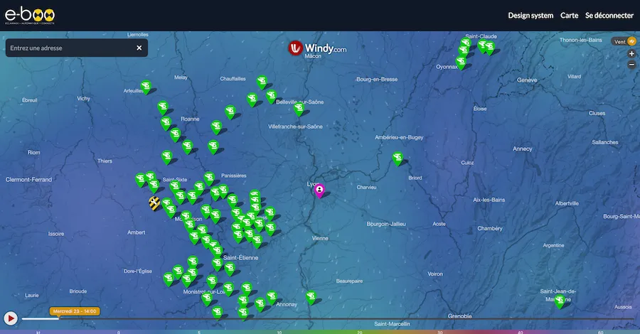
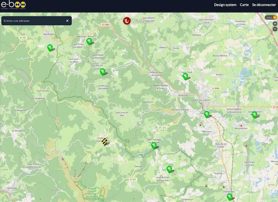
The imagined web product was designed to be used mainly on tablets and laptops in a dark and noisy environment (helicopter cockpit, mainly at night). Once the user is authenticated, they are geo-located on a map which offers a series of weather layers: wind, temperature, atmospheric pressure, cloud height, etc. These elements are offered by the Windy solution, on which we have placed as an overlay all of the DZ (Drop Zone), the famous zones for placing helicopter rescue services.
The map is supplemented by boxes equipped only with weather stations, as well as a 360° webcam with night vision allowing increased monitoring of flight conditions over the territory.
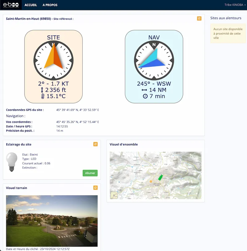
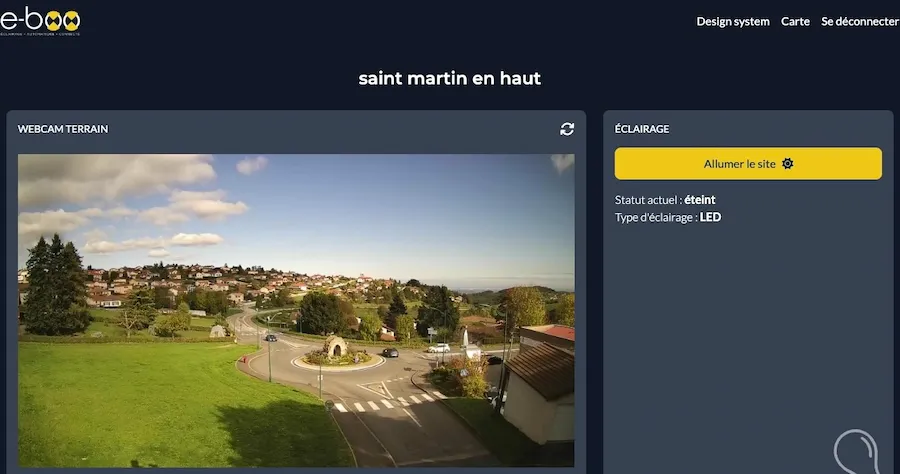
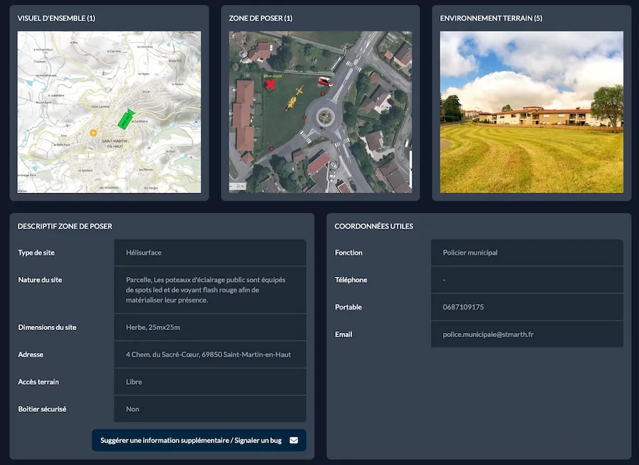
Once the DZ has been selected, the crew has access to a complete identity sheet for the landing zone: general information, approach charts, webcam feedback from the zone, weather information, navigation tools to the zone. The crew can also remotely control the lighting in the DZ and monitor its availability throughout the emergency response.
Our customers words
Romaric Pibolleau, Founder @RP2I
(Translated from French)
I work as a co-contractor alongside Kinoba on a Symfony/React website, and I recommend their professionalism, their reactivity, the quality of our discussions. A special thanks to the Gabriel/Grégoire/Ouriel trio!
I work as a co-contractor alongside Kinoba on a Symfony/React website, and I recommend their professionalism, their reactivity, the quality of our discussions. A special thanks to the Gabriel/Grégoire/Ouriel trio!
